
LINES:
Alberta
Arlington Hts
Beaumont
Bridge Trans.
Broadway
Brooklyn
Burnside
Council Crest
Depot-Morrison
East Ankeny
Eastmoreland
East Side
Errol Hts
Fulton
Glisan
Hawthorne
Irvington
Irvington-Jeff.
Jefferson
Kenton
Kings Hts
Lower Albina
Mississippi Av.
Montavilla
Montgomery
Mount Tabor
Mun. Terminal
Murraymead
N-S Portland
Portland Heights
Richmond
Rose City
Russell-Shaver
Saint Johns
Vintage
Trolley,
Inc. Pages
VTI Route Map
VTI Schedule
VTI Guided Tour
More
Portland
Trolley
History Pages
Car Rosters
Chronology
Company
Chart
This listing is a work-in-progress and will be added to as time allows. The majority of lines described were created around the turn-of-the-century and lasted into the 1930's. See the historical chronology page for information about the traction companies mentioned in bold type.
(click on destination sign to view a map of each line) |
|
 |
The Alberta Line was begun by the first Portland Railway Company c. 1904 as a line serving Union Avenue and Vernon. Successor Portland Consolidated Railway Company officially opened the Alberta Line on July 15, 1905. A large portion of the line utilized a right-of-way on Union Avenue that dated back to 1888, when it was part of the Portland & Vancouver Railway Company's steam railroad to Vancouver, Washington (electrified in 1893). Alberta streetcars originally ran from downtown Southwest 2nd Avenue and Alder Street via the old Steel Bridge to Northeast 25th Avenue and Alberta Street in the Vernon neighborhood. Extensions were made to NE 30th Avenue in June, 1908 and to NE 30th Avenue and Ainsworth Street in March, 1909. The line was converted to bus August 1, 1948. |
 |
The Arlington Heights Line was completed on October 1, 1913 by the Dorr Keasey real estate interests with operation provided by the Portland Railway Light & Power Company. Some maps indicate a brief extension further up Fairview, but it does not show up on early 1930s (Portland Traction Co.) maps. There is also some evidence that earliest operation may have used narrow Parkside Drive rather than Kingston Street, but it is hard to tell since operation in the early years often involved private rights-of-way or dirt streets. The line in final form (orange on map) was in use until converted to gas bus in 1941. |
 |
The Beaumont Line was built by the Beaumont Land Company in December 1911 and operated by the Portland Railway, Light & Power Company. Originally a stub line from Sandy and 42nd, through service to downtown was added in 1914. The line remained in this form until its last years. It was converted to gas bus in 1936 when 42nd was widened and poles removed. |
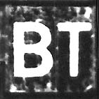 |
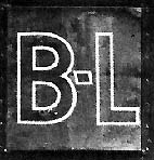
The crosstown Bridge Transfer Line was begun by PRL&P on January 1, 1915 using portions of the old East Side and Russell-Shaver lines. In June 1927, when PEPCO discontinued a separate Brooklyn Line, that route was merged onto the southern end of Bridge Transfer on alternate runs. Portland Traction Company shortened the line during McLoughlin Viaduct construction in 1934. BT was was converted to bus March 23, 1940 and a portion of its tracks paved over. In 1941 World War II contigencies prompted chipping the rails back out and streetcar service was re-established! The buses returned on December 27, 1947. |
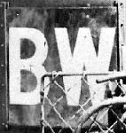 |
The first Portland Railway Company opened the Broadway Line in August, 1903. Cars initially ran from NE 21st and Halsey to the SW Washington Street loop downtown via the Burnside Bridge. In October 1909 the outer terminal was extended to NE 24th and Broadway and in 1910 a shuttle began from NE 22nd and Thompson to the last outer terminus at NE 29th and Mason in Alameda. Service over the Fremont Street loop from NE 24th to NE 22nd was added in November, 1910. After September 1913 the route ran from NE Mason to downtown SW Broadway and Jefferson across the new Broadway Bridge. BW was a high profile line, serving the theater and shopping districts, and it received the last new streetcars in town in 1932 (the "Broadways"). It was converted it to gas bus in 1948. |
 |
The Brooklyn Line was opened in 1901 by the City & Suburban Railway Company. The route was from the SW Morrison St. loop downtown via the old Morrison Bridge and Grand Avenue then out SW Powell to SE 21st and south to Bush Street. PEPCO merged Brooklyn into the Bridge Transfer Line in September 1927. |
|
found of a car on the Burnside Line. But, it appears to have never had an abbre- viated name and may have used only a roll sign on the roof as route desig- nation. |
Service on the Burnside Line was inaugurated in 1903 by the first Portland Railway Company. Original operation was from East Burnside Street and Union Avenue to SE 18th Avenue and Stark Street. In August, 1907 PRL&P extended the route to the westside, crossing the Burnside Bridge to 16th Avenue. But, in 1911 it was reduced to shuttling between 5th and 16th Avenues on West Burnside. The line was dropped in Dec. 1915. |
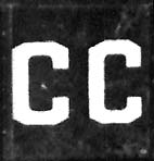 |
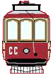
The second Portland Railway Co. opened the Council Crest Line as an extension of the Portland Heights Line on Sept. 20, 1906, a year before the Council Crest Amusement Park was finished. At first it functioned as a stub line from the end of the Portland Heights Line at Southwest Vista Avenue and Patton Road, but by 1908 some cars were running all the way from downtown to the Park, while others turned back at Patton Rd. The name Council Crest Line finally replaced Portland Heights Line after World War I, but trippers continued to turn back at Patton Road. The downtown terminus of the line was traded back and forth over the years between Union Depot and a 5th and Yamhill terminus. In the 1930's the CC line began to use a loop on S.W. Washington and Morrison streets. In August, 1949 shuttle buses replaced trolleys on the upper loop to Council Crest Park and trolleys once again terminated at Southwest Vista Avenue and Patton Road. Council Crest was one of the last three city streetcar lines to go when it was converted to gas bus on February 26, 1950. |
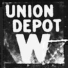 |
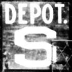
PRL&P created the Depot-Morrison Line in 1907 by adding a Union Depot terminus to the old City & Suburban "M" Line (1892). Track segments included parts of horsecar (Trans. St. Ry. 1883) and cablecar (Portland Cable Ry. 1890) lines. It was one of several lines that gave access to Northwest Portland'sWillamette Heights over the years. The former Multnomah St. Ry. Washington Street line, which began as a horsecar route, ran to Willamette Heights via NW 23rd Avenue until its northern terminus was changed in 1908. The Transcontinental Street Railway's S line also served the Heights via 14th & Savier streets. In 1905 the 16th Street, W - 23rd Avenue, S - North and South Portland and M - Morrison lines were rerouted to serve the Lewis & Clark Exposition in Willamette Heights. Afterwards, the Depot & Morrison run carried an "M" dash sign when inbound to downtown and a "W" sign outbound to Willamette Heights. On October 14, 1923 the Depot & Morrison line was discontinued and a new downtown loop added to its old route through Northwest Portland to create a "new" run known simply as the Willamette Heights Line. |
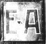 |
The East Ankeny Line was built by the City & Suburban Railway in 1892. The Portland & Fairview Ry.'s line to Mount Tabor Villa was built at the same time, and used the East Ankeny route to gain access to downtown. Soon alternate cars were running to Mount Tabor Villa and East Ankeny. By May of 1913 EA had been combined with the Montavilla Line (the new name was a contraction of Mount Tabor Villa) and discontinued as a separate Line. |
 |
The original East Side Line was a horsecar route along Grand Ave. opened by Willamette Bridge Ry in 1888. An 1890 carbarn fire hastened conversion to electric operation and by 1892 C&S had extended the line westward to connect with Albina cars. In 1909 PRL&P merged this route into the Russell-Shaver Line. In 1914 a different East Side Line began running from the new Broadway Bridge, but a year later the East Side name vanished for good with a merger into the Bridge Transfer Line. |
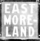 |
The Ladd Estate Company began building the standard gauge Eastmoreland Line in 1910 during the construction of Reed College on pasturage of Ladd's Crystal Springs Farm. Passenger and boxcars for this new stub line were leased from PRL&P. A passenger car was run over the line the next year for the ceremonial laying of the Elliot Hall cornerstone. In 1912 rail was rerouted down Southwest 32nd to the new Eastmoreland real estate development and the original tracks to the campus were removed. The line was then donated to PRL&P, which officially opened it in March, 1912. The Eastmoreland line merged into the Errol Heights line in 1926, three years before conversion to gas bus. In 1936 a trolley bus service was begun using the same name, but with a very different route (including parts of the Richmond and Waverly-Wood lines) which merely terminated in Eastmoreland. |
|
found of an Errol Hts car. |
The Errol Heights Line was opened in 1913 by PRL&P. Like most stub lines it was built by real estate developers and was, at first, promoted as "the world's only free trolley line." This standard gauge line was a branch of the Eastmoreland Line, running from the EH terminus at Southeast 32nd out Southeast Knapp and Rex Streets to Southeast 52nd Avenue. Cars ran from SW 13th in Sellwood via the EM Line according to historian Randall Mills, who claimed that Errol Heights trolleys met Sellwood cars. The EH Line was replaced by gas bus in November,1929. |
|
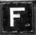
The Metropolitan Railway's historic
Fulton
Line was the first electric line on the West Side, opening on
New Year's Day 1890 (two months after the Albina trolley). It was
intended to run south to West Linn, but the owners began building an
interurban on the other side of the river instead. When the
Fulton run reached Riverview Cemetery in 1891
it (briefly) become the longest electric railway in the state at six
miles. Access to downtown was secured by converting the old
Portland Traction
Company horsecar line on 2nd Avenue to standard gauge electric
operation. Yet, in 1897 the City & Suburban Ry.
began changing
the whole Riverview line to narrow gauge, necessitating a transfer to
standard
gauge cars in South Portland for several years. When the
regauging was finished in 1900 the original private right-of-way to
Riverview Cemetery was abandoned. The Fulton Line was
discontinued in 1923 when it merged with North and South
Portland. However, an "F" dash sign continued to be used to
signify North and South line cars running south to the former
Fulton line terminus. |
|
of a Glisan Street Line dash or roll sign. |
The Glisan Street Line ("G" Line) began in 1883 as the first Transcontinental St. Ry. horsecar line. City & Suburban ry. electrified the G Line in 1892. By 1900 it had been combined with the Montgomery St. Line to form the M-G Line. PRL&P merged part of this route with the S (Savier) Line, (which itself would soon become the North and South Portland Line) and the remaining portion had been tacked onto the Mount Tabor Line by 1908. Thus this former horsecar line didn't survive long into the PRL&P era. |
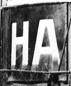 |
The standard gauge Hawthorne Line started as the Mt. Tabor Railroad, a steam dummy service built by Mt. Tabor Street Railroad Co. in 1888. It initially ran from Grand Ave. to 54th. The line was purchased by the East Side Railway in 1891 which connected it to downtown via the old Madison St. Bridge and electrified it in sections during 1892-93. Extensions were made southeastward during the next few years. In 1907 PRL&P added the dual gauge Alder St. Loop as downtown terminus. Although it remained standard gauge until the end, Hawthorne became part of the city (as opposed to interurban) division by 1914. Portland Traction changed HA to trolley bus in 1936, and then gas bus about 1949. |
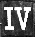 |
The historic Irvington Line was one of the first half dozen trolley routes in town. It began life as Willamette Bridge Railway's Holladay Addition Line in 1890. But, within months City & Suburban Railway had changed the name to Irvington. During the period 1910-13 PRL&P extended the line. In 1914 it was merged with the Jefferson Line to become Irvington & Jefferson (IJ) and dual terminuses, on Stout and Mill, replaced the old 3rd/2nd loop (the Mill portion was discontinued in 1928). The line became just Irvington again in 1933 when Portland Traction Company removed Jefferson St. from the route and replaced it with a 5th/Broadway loop. Irvington was converted to gas bus in 1940. |
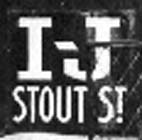 |
PRL&P created the Irvington & Jefferson Line in 1914 when it merged the old Jefferson Line with Irvington. Alternating West Side terminuses, on Stout and Mill, replaced the Irvington Line's 3rd/2nd loop. The Mill Street terminus, where passengers had changed to cable cars prior to 1904, was not dropped until 1928. In 1933 Portland Traction Company discontinued streetcar service on the Jefferson St. portion of the Irvington route and the line became just IV again. |
 |
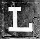
The Jefferson Line began as the City Park line, built by Portland Cable Railway in April, 1892. The line ran from Union Depot to the south side of City Park near present day Canyon Road via Southwest 5th Avenue and Southwest Jefferson Street. Prior to installation of the Washington Park reservoir a short extension existed from Jefferson north to Southwest Kingston Street where there were baseball grounds. The line was converted to electric operation by the first Portland Traction Company on May 1, 1896. PRL&P discotninued service to Union Depot in September, 1910. But, in 1913, an extension was made to the North Bank Depot at Northwest 11th and Glisan streets. The Jefferson Line was merged onto Irvington in February, 1914 to become Irvington-Jefferson. By this time the line no longer ran under the Vista Avenue Bridge to City Park; there were dual western terminii at Southwest Chapman (now 18th) and Mill streets, and at Southwest Jefferson and Stout streets. In 1933 the Jefferson portion of IJ was discontinued. |
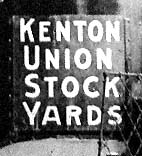 |
There were two Kenton lines, both of which began as stubs. Swift Packing Company's
Kenton Stockyards Line
ran from the end of PRL&P's Kenton line at North Derby (now Denver)
and Kilpartrick Streets to the Union Stockyard, Stock Exchange and
Swift's packing plant on what is now North Marine Drive between 1909
and 1928. PRL&P's Kenton Line
was a stub running from the Mississippi Line at North Killingsworth and
Albina Streets to North Denver and Argyle Streets in the company town
of Kenton via North Albina Avenue and Lombard Street. It began
operation in September, 1909 and was merged into the Mississippi Line
in October, 1912, after which the Mississippi Line had alternating
terminals at North Albina and Lombard Streets and North Denver and
Argyle Streets. Kenton Traction Company leased
equipment
(mainly former C&S Ry. cars) for the KS line from PRL&P.
Their service to the stockyards was dropped at the end
of 1928. Service to Kenton via the Mississippi Line lasted until that line ceased operation in 1940. |
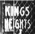 |
Like other heights lines, Kings Heights was built by a real estate company and turned over to PRL&P for operation. The Kings Heights and Mt. Calvary Line opened in 1911 as a stub service from NW 23rd Street. Much of the route was over curved trestles and steep grades on private rights-of-way. Most of the portion at the end of the line, from Valle Vista to the cemetery, had originally been part of, or at least surveyed for, the long defunct Barnes Park Heights and Cornell Mountain Railway (1893). In 1927 PRL&P dropped the cemetery portion of the line, which was taken over as a separate service by United Railways Co. Portland Traction Co. converted Kings Heights to gas bus in the late 1930's. |
 |
The Lower Albina Line was part of the first electric streetcar route in the state. Willamette Bridge Railway opened the Albina Line in Nov. 1889. Successor City & Suburban Ry. split the two halves of the Albina loop into the Upper Albina and Lower Albina Lines and began extending the Lower Albina portion northward. It reached Beech St. in 1901. By 1905 Portland Consolidate Ry. had pushed the "L" Line to a junction with the Russell-Shaver Line at Shaver St. After PRL&P took over in 1907 the line was extended to meet the old St. Johns Steam Motor Line (electrified since 1903) at Killingsworth. PRL&P also rerouted the downtown portion of Lower Albina to use the Burnside, rather than Steel, Bridge. During the PRL&P years Lower Albina evolved into what became known as the Mississippi Avenue Line. In 1907 it was listed as "L Mississippi Avenue," and in 1912"L Mississippi and Kenton" (after the Kenton Line was added to it). The line finally became just Mississippi Avenue or "MA" after it was rerouted over the Broadway Bridge in 1916. |
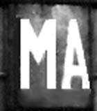 |
The oldest portion of the Mississippi Avenue Line began as part of the first trolley line; Willamette Bridge Railway's Albina Line (Nov. 1889). By 1901 City & Suburban Ry. had split the route into the Upper Albina and Lower Albina Lines. PRL&P merged the Kenton Line with Lower Albina to form the "L" Mississippi and Kenton Line in 1912. The line was further lengthened after the Broadway Bridge route to downtown was added in 1916. The old Lower Albina identity had now faded and the line was known as just Mississippi Avenue from the non. About 1936 MA was extended for the last time. The northern terminus was moved three blocks using part of the old Kenton Traction route. The line was soon to be converted to trolley bus (some say in the late 1930's others say it was not until the 1940's). It became a gas bus line in 1958. |
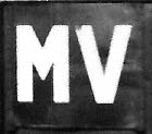 |
The Montavilla Line's downtown loop utilized a portion of two Transcontinental St. Ry. horsecar lines (1883). The route across the Morrison Bridge was also originally a horsecar run, Willamette Bridge Ry.'s pioneering East SideLine. The portion of MV to 28th opened in 1892 as City & Suburban's East Ankeny trolley. The remaining portion of the line, to North Mount Tabor, was built for the Portland & Fairview Ry. During the 1890's cars alternated between East Ankeny and Montavilla destinations. By 1899, when C&S acquired ownership of the both lines, the community of Mount Tabor Villa, and the line it served, had adopted the name "Mountavilla," a contraction that had first appeared on roll signs. An addition was added in 1911 to the Mt. Hood Ry. station at 91st off Glisan. In 1913 East Ankeny was discontinued as a separate line. MV was converted to gas bus in 1948. |
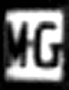 |
The Montgomery St. Line began in 1886 as a Transcontinental St. Ry. horsecar line. The northern portion was electrified in 1891 as City & Suburban's G (Glisan St.) Line. The southern portion was electrified within a year as the M Line. By 1900 a combined service was known as the M-G Line. PRL&P merged the Montgomery St. Line with the Mount Tabor Line around 1906 and it ceased to exist separately. MT first added the G Street portion in 1905, and then traded that for the M Street part in 1908 (when much of the G Street route went to the N & S Portland Line). |
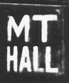 |
The Mount Tabor. Line , opened by Willamette Bridge Ry. in 1888, was the area's first steam dummy line. It first ran from East Portland to Sunnyside, but was extended to Mt. Tabor the next year. In 1892 a short-lived steam line, the Portland, Mt. Tabor & Eastern, began running from the Mount Tabor terminus to 102nd & Stark. C & S electrified Mt. Tabor in 1892 and extended it into downtown. Several changes were made to MT Line terminuses over the years, particularly on the West side. Service to the Lewis & Clark Exposition grounds in N.W. Portland was added run for a couple of years starting in 1905, and then the west side terminus was cut back to SW Yamhill in downtown. A year later the Montgomery St. Line was attached to MT. After 1909 Sunnyside was operated as a separate line with its own terminuses (see SS Line page), and MT began running from SW 13th & Hall to SE 69th. By 1913 MT ran from SW 11th & Yamhill to SE 88th St. in Montavilla. Around 1933 the downtown terminus became a loop running from 13th & Hall returning via 11th. MT trolleys were replaced by gasoline buses in 1948. |
|
of a Municipal Terminal (M-T) sign |
The Commission of Public Docks built the Municipal Terminal Line to provide access to their remote new Terminal Number 4 north of St. Johns in 1920. PRL&P, and then PEPCO, operated a car over this line until October 1929 when a bus took over. The 1.5 mile stub ran from the end of the SJ Line to the Administration Building. |
 |
PRL&P created the Murraymead Line in 1913 as a standard gauge stub to the Hawthorne Line. Portland Traction discontinued MM in 1936, although the approximate area served would become the 52nd Av. bus line. For most of its life the MM Line was served by the little four wheel Safety Birney cars. |
 |
The North & South Portland Line used parts of two older franchises. The northern portion used the Transcontinental St. Railway's S (Savier) St. Line, which had been electrified in 1891. The southern portion was added about 1900 when the City & Suburban Ry. extended the S Line further into South Portland using rebuilt former Metropolitan Ry. rights-of-way. C&S called the resulting line "S - North & South Portland," but during the PRL&P years the line became just "North & South Portland". A new northern terminus was tried for 5 years, after which the line stayed essentially the same until the Fulton Line was merged with NS in 1923. NS was converted to trolley coach May 23, 1937 and became the "3rd Avenue" gas bus August 10, 1953. Today this route is served by two different bus lines. |
 |
The Portland Heights Line was begun by the Portland Cable Ry. Co. in 1890, even as the first electric streetcars appeared in town. In 1896 new owner Portland Traction Co. converted cable trackage to electric operation, leaving cable cars only on the hill running up to Spring St. By 1902 the trolleys (some of which had been converted from cable cars and had both grips and trolley poles!) were described as serving the "5th Street Line, Union Depot and Portland Heights," although passengers bound for the Heights had to transfer to cable cars at the base of the trestle on 18th (Chapman) Street. The last cable cars were not retired until 1904 when the Portland Heights Line was re-routed to use the new Vista Avenue Bridge. An extension to Council Crest was added in 1906, and by 1918 the name Portland Heights gave way to Council Crest in timetables and guidebooks (see CC Line above for remaining history of this route). |
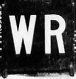 |
The Richmond Line is one of the oldest in town. The tracks it shared along 5th Avenue (now Grand) and across the Morrison Bridge were laid in 1888 as part of the Willamette Bridge Ry. Co.'s "Portland-East Portland" horsecar line. Electrification began in 1890, following a carbarn fire, and was completed the next year by the City & Suburban Ry. Co. The "Waverly-Woodstock Motor Line" split into two branches at S.E. 26th & Brooklyn, with some cars serving the neighborhood of Richmond and others continuing on south to Woodstock. Early cars on this line sported clerestory signs for "Waverly & Richmond." From the turn of the century these two lines were sometimes listed as "Woodstock" (WS) or "Richmond" (RM), while at other times they were given longer "Waverly-Woodstock" (W-W) or Waverly-Richmond" (W-R) names. Although originally narrow gauge lines, PRL&P regauged them to standard gauge in 1908, after which they were served by streetcars from the Sellwood, instead of the Ankeny, Carbarn. The Richmond Line was discontinued September 27, 1936 (Woodstock continued as a gas bus line). |
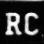 |
Rose City Park Line service was inaugurated by Portland Railway, Light & Power Co. in 1907 as an addition to the East Ankeny Line. The new right-of-way was built and owned by Hartman & Thompson Realtors. Original service was via the old Morrison Bridge, but was changed to the Burnside Bridge in the 1910's. The line's downtown loop was via 2nd, Washington, Burnside and 5th until 1914, when 1st Ave. replaced 2nd. The East Side terminus was 67th and Sandy until 1912, when the RC car was extended to the city limits at 82nd and Sandy. A spur line served the Portland Country Club, which began as a horse racetrack in 1908, became an auto speedway in 1926, and is now a city park and golf course. The Rose City Line became the Sandy Blvd. trolley coach line on Nov. 30, 1936. It was converted to gas bus June 12, 1955. |
|
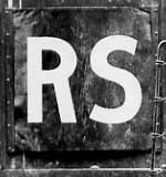
The
Russell-Shaver
Line began in 1903 as a Portland Ry. Co. stub line
running between Russell and
Shaver Streets in North Portland. Successor Portland
Consolidated Ry. extended their Lower Albina Line to a junction with
R-S at Shaver and Mississippi in 1905 giving R-S riders an additional
place where they could transfer to a downtown line. R-S briefly
gained a direct connection to town in 1907, when Portland Railway,
Light and Power Co. routed R-S cars over the Burnside Bridge.
But, this was dropped within a year. The next
route change came in 1909, when the the old Willamette Bridge Ry.'s
East
Side Line (Grand Avenue) was appended to the Russell-Shaver run.
That alignment was taken away too, when Grand Avenue trackage
became part of the new Bridge Transfer Line in 1915. Some directories
indicate that a northern terminus change, or perhaps a real estate stub
addition, was made around 1911
on Maryland St. However, by the PEPCO years (1920's) the R-S
route looked
much as it had at the beginning. The Russell-Shaver Line seems to have
been
abandoned in the 1930's, perhaps as part of the new franchise agreement
in
1936. |
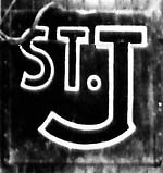 |
The St. Johns Line
is an old one, having started as Willamette Bridge Ry. Co.'s
"St. Johns Steam Motor Line." The steam short line opened to the
outskirts of the town of St. Johns in the late fall of 1888. By
May 12th, 1889 the northern terminus had been extended to Burlington
St. in St. Johns, via a partial loop running from Wall
to Jersey Streets. The entire loop wasn't completed until 1911.
The line's southern terminus, at Stanton and Commercial Streets
in Albina made connection with the state's first trolley, the "Albina
Electric Line," which was also owned by WB Ry. Successor City
& Suburban Ry. converted the St. Johns Line to electric operation
in 1903 and began running St. J cars
into downtown over the old Steel Bridge (as with the Albina lines). The
"legs"
at the bottom of this line (the route through Albina) was changed from
the
stub line terminus at Commercial St., to Williams Ave., then Union Ave,
and
eventually Greeley. The line changed bridges several times as
well,
moving over to the Burnside Bridge around 1911, and then the Broadway
Bridge,
after it was completed, in 1913. Each of these bridges had its
specific
"loop" through the downtown area, with Burnside using 5th, Washington
and
2nd, and Broadway using 5th, Washington and Broadway. Portland Electric
Power
Co.(PEPCO) made the final change to the St. J. Line about 1918,
utilizing
the new Greeley Cutoff into North Portland. The line was
converted
to trolley bus April 11, 1937 and to diesel bus in 1958. |
Back to top